 |
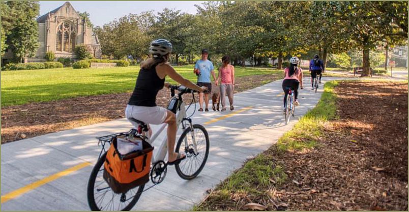
| Typical Path Foundation Photo - Unobtrusive Paths don't scare me, I just wish we had this space. |
Tonight City Council Chambers were at capacity, mostly to provide comments on the trail system but a special Kudos goes out to Peachtree Middle School Principal Michelle Perez who attended our meeting to thank us for the proposal for artificial turf on the PMS Football Field.
Our meeting started at 5 pm today and there was still a good crowd of citizens who stayed until 9:30 to hear the issues and to make their own comments. Kudos to them and everyone else who attended and or spoke, either pro or con.
Numerous residents spoke on the draft trail plan and believe it or not, I am a fan of making many of these infrastructure improvements but I would want to scale some of the projects back to 8 feet allowing more room for greenery, trees & shade and this plan does not allow for anything under 10 feet.
Many residents speaking against the paths were speaking about specific paths that personally affected them, they spoke of problematic aspects of the path plans that they would like to see removed from the plan. Some of the proposed paths they had issues with were to Dunwoody Elementary School path from the neighborhood, the path along Nancy Creek, the Brook Farm community didn't want a spur, the Stevens Walk Community still wants assurances that a trail would come on their east side of Tilly Mill and finally a resident of North Peachtree questioned the last minute addition of the 10 foot path that was added to the bond list. On the other side of the coin, there were pro comments wanting path ways added that were missing from the draft plan.
Of the six council members, I seem to be the odd man out, wanting to move more cautiously on these trails because of the negative impacts (real or perceived) on those adjacent to the proposed infrastructure. We heard general residents saying move forward and others saying this this might be for the greater good, but how is the city going to protect me, my property and my privacy from this 10 foot trail abutting my property, cutting through my backyard? Those questions were not answered and I can tell you that when it comes to infrastructure installation, the details really matter otherwise it is usually the resident that feels the negative unintended consequences.
At the end of the council conversation, the mayor pushed back and said this plan should give residents what they want without excessive harm to residents affected. She questioned the consultants on cost, the order of recommended construction, what paths would serve the greatest good. She asked about other cities who have installed paths in front of single family homes. Based on her comments, I am guessing that this master plan will be reviewed and tweaked by staff based on issues raised, it may be vetted to the community again or the subject may be back at the next city council meeting for more discussion and maybe a vote for approval. We'll have to wait and see.
Heneghan comments of 4/24/23 on trails.
"Today we are discussing the Draft Dunwoody Trail Master Plan that will be
set as the defacto trail construction standard and I believe this document
needs to be further vetted, tweaked and tightened up to accurately document the
desires of our community, especially as related to paths in the residential
districts.
Last week Councilman Lambert and I spent over an hour with 50 residents of a
sub-division talking about one sentence in the plan that stated the path would
enter into their community where there was no public access point, because that
community would prefer to not have path access.
I was on Council when the Brook Run Trail was conceived, funded and implemented, therefore I am a strong advocate for paths, when they are in the appropriate places. I was also a strong advocate for the buffering of that trail so not to negatively impact the homeowners adjacent to that path.
Based on current wants and desires of the community, I too want improved infrastructure throughout the city to improve walkability, room for strollers, wheelchairs and even bicycles to be able to move freely within our community.
Unfortunately, I also have grave concerns over the plans being presented today as the negative impacts on the individual homeowners have not been taken into consideration when these paths are placed in front of single-family homes.
Like all infrastructure projects the devil is in the details, as these plans don’t allow wiggle room to go below 10-foot-wide paths in residential districts, I wish there were other options. At the very least, the Community should be aware this is happening, public notice should be given and a city-wide conversation should be happening before final approval. This meeting is a good start, but I think more information sharing and gathering is needed.
I have raised objections to Council and to the community via my blog, as I believe it is an obtrusive overstep of filling the allowed right of way, with excessive concrete which limits greenery & beauty. Are there no scaled back options at a lower cost that can also serve the greater good? What are the minimum landscaping measures that accompany these transportation improvements?
These big trail master plans are not fully engineered except that we know 10 feet of concrete is the minimum for a multi-use “Greenway” path We have no clue as to the actual greenery that will need to be removed, we have not openly discussed these plans with the affected residents along the path, have not discussed the financial considerations or lower cost options, yet this plan could be on the next meeting agenda for formal action including possible approval. I hope we slow it down a bit.
Public Safety
We purposely installed on the road bike lanes on Mt Vernon and other places so that when 285 is shut down or gridlocked and the traffic enters our surface streets, that there would always be a safety factor on the surface streets to allow fire trucks and ambulances to move freely. Mount Vernon typically has two 11-foot travel lanes and two 5-foot bike lanes which in the time of need allows all cars to move over to the right allowing emergency vehicles down the middle. Q1 - The path plan isn’t very clear, what is the current width of Mt. Vernon and can cars still maneuver out of the way of emergency vehicles?
Right of Way / Property Rights / Buffers / Screening
I have read in this document that working within the right of way is the goal but at times easements or property purchase will be needed to make these plans a reality. If the resident refuses easements or sale, I am guessing the first option is to move the path or modify the width of the trail. If a resident refuses to sell or grant an easement for the project, then I guess the Council may need to consider eminent domain to acquire the rights needed to move forward.
Question raised by resident - There are numerous buffers identified whereby the path has to have a minimum buffer from the road but there is no minimum buffer between the edge of the trail and a home. There is no discussion of the city screening the trail from homes. Why not? Q2 - Are these buffering and screening decisions of Council to make with every project or is it better to have guiding principles listed now for uniformity in buffering & screening throughout the city?
Calm Streets
The path plan states - Calm streets are located where both traffic volumes and speeds are low; they are designed in collaboration with neighbors to give priority to pedestrians and bicycle riders. Calm streets work best where there are already sidewalks or where sidewalks can be included. (page number 14 or page 20 of 88).
This draft Trail Master Plan also envisions "calm streets" with forced traffic calming measures like speed humps. We currently have a traffic calming policy that is data driven, requires neighborhood buy in and resident payment for the upkeep of the traffic measures. Q3 - How does this Calm Streets path plan relate to our traffic calming policy?
There are no sidewalks where Calm Streets are listed (Sudbury, Dunkirrin, Riverglenn Circle)? Do sidewalks go in before the citizens vote? What if I want this on my street but it is not listed on the plan, can you install, who pays?
Finally in E7 - There is section of 10 foot concrete greenway along the Doraville / Dunwoody border where Doraville just approved numerous town homes on their side of the creek and the Dunwoody homes directly adjacent to that creek already have a flooding history. As a neighbor in that community, I would like more details as to the specifics of this path to ensure building in the floodplain will not negatively impact the Dunwoody homes.
Again, my hope would be to slow down this process and have several open houses so the residents can provide appropriate feedback as to the trails directly affecting them. We had numerous data gathering sessions on the front end of this project and I would suggest that we do the same on the back end so that it accurately matches the desires of the community.
I appreciate the Citizen input and research done by the Path Foundation, but I don't think this draft report is ready for prime time, let alone ready for approval for full implementation.
Thanks, now let’s get back to those three questions I had.

2 comments:
"....scale back options at a lower cost that still serve the residents ..." John I thank you for ALL your comments, and I also hope we slow it down somewhat.
John; thanks so very much for highlighting and sharing the important, very important aspects of this massive plan...I hope this gets shared and distributed widely, so that individual citizens can REALLY know what is in this plan
Post a Comment